mom kid control41.JPG

New to Orienteering?

The best way to learn about Orienteering is to come to the next event. Someone there will get you started.

Below is some basic information about Orienteering. Web searches will turn up lots more about about the sport, but we recommend starting with the Orienteering USA website.

What to expect

When you arrive at the event, fill out registration form and any waivers. You will receive your map and a start time. We stagger the starts so that people on the same course aren't all going at once. So, start time from 10 to 12 means you can show up anytime between those hours to begin your race.

Instructions are available upon request.

Go to the starting position. Do not begin the course before your beginning time is marked on your card because time matters for scoring. 

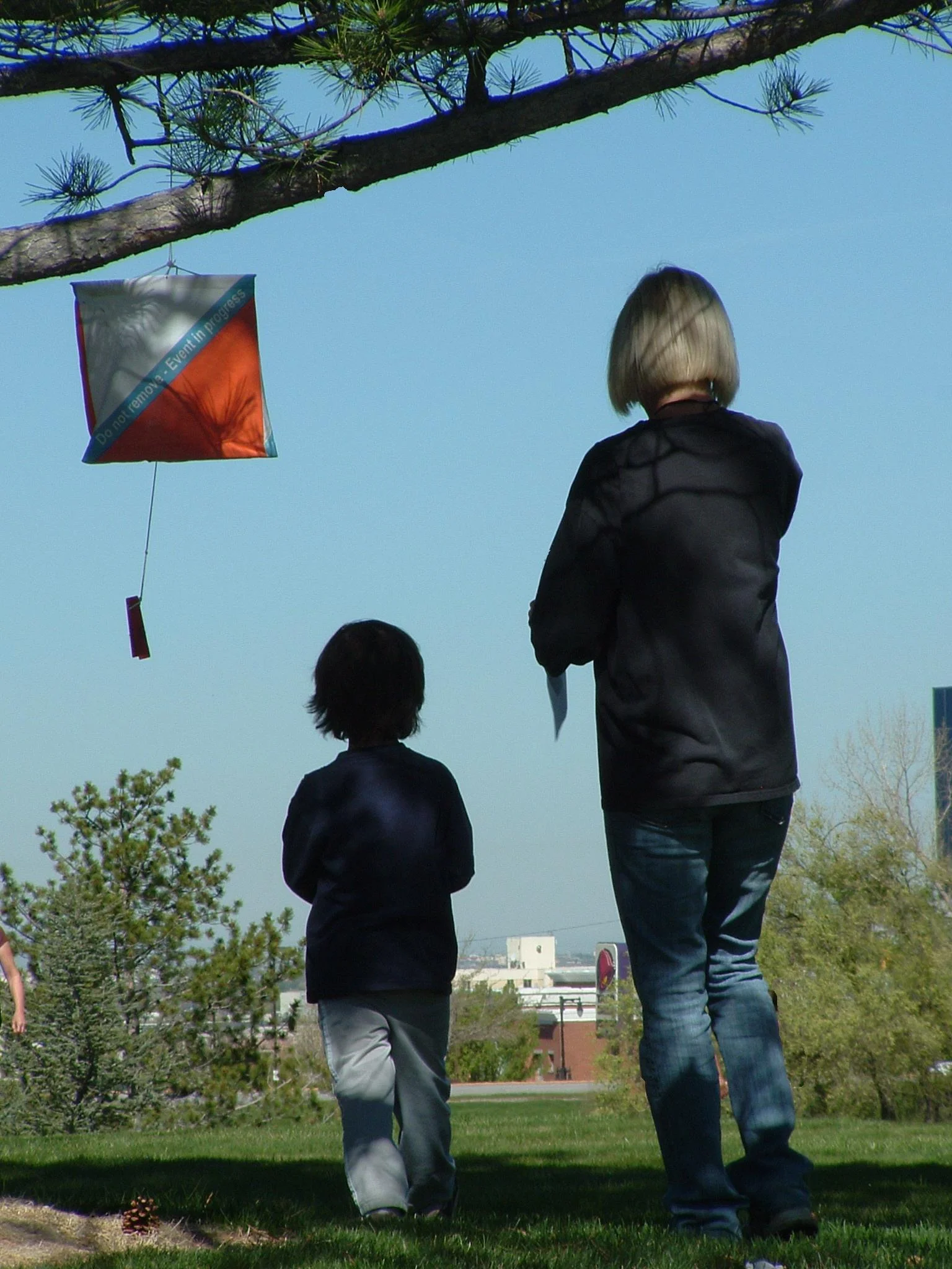
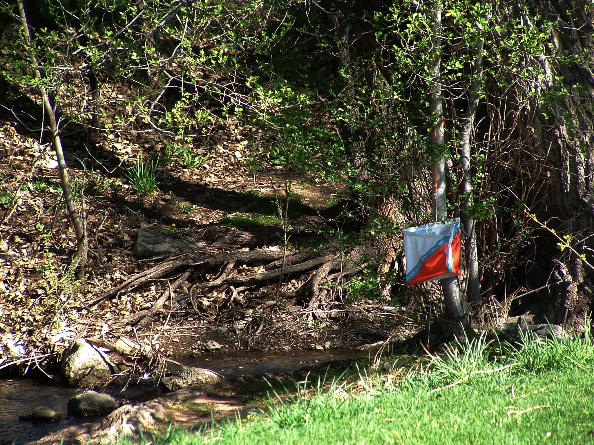
From start (triangle on the map) go to the first control (circled on the map with a #1), then go to #2, #3, etc...in that order.

Generally it takes about an hour to complete a course. A beginning course may only take 30 minutes while an advanced course may take a couple of hours. The time limit is usually three hours. A "quit time" might also be specified and after that time the course is taken down.

Make sure to go the finish (double circle on the map) whether you finish the course or not. We need to know who is still in the woods! Please avoid leaving without checking in as it can cause an unnecessary search. Also, if you don't come back in we can't score your card.


What to bring

Dress as you would for a hike or run. For intermediate and advanced courses you might want long sleeves and rugged pants for "bushwacking" but serious Orienteers actually wear light nylon running suits with gaiters over their shins. The most sensible item would be comfortable athletic shoes. Also consider a water bottle or hydration pack, especially for hot days.


Compasses

A compass is not necessary for beginner courses. If you have one, bring it and we will show you how to use it. The faster and more responsive the needle, the better the compass will handle the sport of orienteering. The club has a small collection of compasses available for use during meets, we just ask for collateral (usually car keys) to make sure they are returned.


Maps

Most orienteering maps are either 1:10,000 or 1:15,000 scale, with sprint events being even larger in scale proportion. basic legends are included indicating type of terrain (open, wooded, rocky, etc) as well as some of the features symbols you'll typically encounter. Take time to compare orienteering topographic maps to a standard road maps on google to get a better feeling for them.

Event Fees

We currently ask for a donation of $20 per entry to help us cover equipment, printing, park registration, snacks and the various organizational overhead expenses like association dues and website costs. Please thank the Meet Directors and volunteers for their donation of time and energy to bring you such fun and inexpensive athletic activities!


course Types

Decide which of the courses offered best fits your skill level. Sometimes our meets have simply a "beginner," "intermediate," or "advanced" level course offered. Here are the definitions of the color-coding Orienteers use. Differences in courses are based on navigation/map skills and climb/distance difficulties.

  • White (novice) - short and easy.

  • Yellow (advanced beginner) - rather easy, designed along strong linear features, a good first course if you have some map reading experience.

  • Orange (intermediate) - designed around distinct features but good navigational skills are required.

  • Brown, red, green, blue (advanced) - difficult, sometimes very difficult. The only differences in these courses is the length. Brown is short, blue is very long (up to 12 km).


Score-O

Instead of a fixed course, participants visit as many controls as possible within a fixed time, e.g., 30 minutes. More distant or difficult controls are often allotted a higher point value. Points are deducted for each amount of time the orienteer arrives after the allotted time is up, say 5 points for every minute. The person with the most points wins.


Trail orienteering (TrailO)

This format of orienteering  involves precise reading of an orienteering map and the corresponding terrain. Trail orienteers must identify, in the terrain and in the presence of decoys, control points shown on the map. TrailO involves navigation skills but unlike most other forms of orienteering, it involves no point to point racing and little or no route choice. It is conducted usually on trails and because the objective is accuracy, not the speed of physical movement, the sport is accessible to physically disabled competitors.  

Unlike other forms of orienteering which involve the competitors physically visiting the control and punch it, trail orienteering is done in form of multiple choice questions, where all questions are in the form which flag is placed at the control on the map, and the possible answers are one of the flag (A, B, etc.) seen from the decision point, or none (Z). 


Schedule

The club typically holds at least one event per month from spring to fall at various community parks and wilderness areas throughout the Salt Lake Region. Dates, times, and meet info are listed here.

Results

While we have a digital stash of results dating back to the clubs beginning, here are records of the current meet standings and summaries as well as a link to results from previous years.

Resources

A section of the O-Utah site dedicated specifically to learning the nuances of the sport (international symbols, topographic features, etc.) through various linked content and media.

13938632_1472068672819337_2575566309323653605_n.jpg
 

Club Membership!

In order to increase participation, streamline communication and grow our volunteer base, we are offering yearly club memberships!

$30 for either individual or household (Free to those volunteering to help direct events). You’ll receive a 50% discount on entry to all Orienteering Utah events and some cool club swag. Please consider signing up at the next meet!


november 2007

"I love the feeling of running fast through the woods, unconfined to trails and able to go through any terrain. Finding the controls adds a sense of purpose, adventure, variability and focus."

Suzanne Armstrong | Attackpoint Member


control stream18.JPG
 

Club Officers

 
1935389_1133944136639320_3380412313541926293_n.jpg

Ian Hoag, President

k15679137-default-male-and-female-facebook-profile-image-785x505-860x450_c.jpg

Current Vacancy, Treasurer

14484913_10153714953256152_4340668092305745877_n.jpg
 

Fletcher Hamel, VP | Marketing & WEB

14424804_1391626934181104_5210062167426972740_o.jpg

Bob Huebner, Director of MappinG


Meet Directors

Rich Allred
Leif Anderson
Joshua Ball
Doug Bergman

Sterling Broadhead
Catherine Chamberlain
Tyra Christopherson

Janice Gardner
Darin Garrett
Fletcher Hamel

Ian Hoag
Bob Huebner
Cole Mortensen
Rick Oliver

Darren Stanger
Gabe Svobodny

Past Presidents

Suellen Riffkin
Kent Thygerson


Volunteers are needed and welcome at meets. Help us out with event registration, course clean up, and more! Reach out to us through Facebook or our contact form indicating your interest in joining us in sharing this sport with our local community and subscribe to our mailing list below. We send a reminder email about upcoming events once a month.